Free data set now available for download
Berlin, Germany —
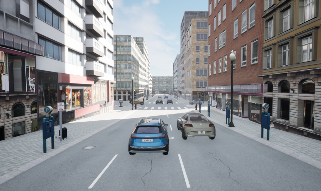
Several months ago, TrianGraphics partnered up with atlatec GmbH, a German company that produces HD maps for autonomous vehicles, ADAS, simulation, and localization. The main goal of the cooperation was to take another step towards providing more realistic AV/ADAS simulation scenarios. As a result, we created a 3D environment from atlatec’s HD map of Downtown, San Francisco.
Image: Visual representation of HD maps of San Francisco in Carla simulation tool.

The terrain was designed based on real-world OpenDRIVE data that was acquired with one of atlatec’s sensor pods and processed for high accuracy and fidelity, allowing for very precise and realistic rendering of the visual environment. By using atlatec’s HD maps in conjunction with Trian3DBuilder, users can export the high definition data to the main simulation engines.
Take a look to the San Francisco Downtown video here
Download free sample data from our customer portal, or atlatec website
“Our work with TrianGraphics resulted in a visual recreation of real-world HD map data acquired by our team. These 3D models allow for more comprehensive simulation of AV and ADAS sensors and systems, bringing them one step closer towards safety and reliability”, says Dr. Henning Lategahn, founder and CEO of atlatec.

“It is always a pleasure to partner with atlatec for such projects. Creating accurate real-world 3D environments is a smooth procedure when using Trian3DBuilder and HD maps from atlatec. Testing and validation of ADAS and AV systems can then be performed in highly realistic virtual scenarios” says Stephan Kussmaul, Managing Director of TrianGraphics
About atlatec:
Atlatec Gmbh is a German company that produces HD maps for autonomous vehicles, ADAS, simulation, and localization. These HD maps come with inch-perfect accuracy and are currently used by autonomous industry leaders, automotive OEMs and suppliers in the USA, Europe and Japan. atlatec HD maps can be leveraged anywhere in the world and at any scale – from entire highway networks to a single proving ground track.